Geoinformation Services
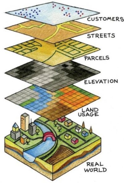
Enhancing your decision making and supporting power using GeoinformationIntegrated use of information from a multitude of sources is required for the success of any project or policy making. Many organisations, including governmental bodies, have found Geographic Information System (GIS) to be a critical tool in resource management, regional planning, and economic development. For the practical use of GIS requires accurate and detailed spatial and demographic data. GeoTech is specialised in designing and generating geospatial database using multiple data capturing and analytical techniques. We undertake a lot of geospatial data conversion projects and has successfully executed many mapping projects from disparate and wide-ranging sources (including ortho photos, satellite images, aerial photographs, and other legacy inputs) and delivered in multiple GIS formats. Our major Services include:
-
Spatial Data Design & Generation
We design and generate the database to assimilate with all existing data, with the required accuracy and ensure the end user success. We are expert in:
● Natural Resource Mapping
● Utility and Facility Mapping -
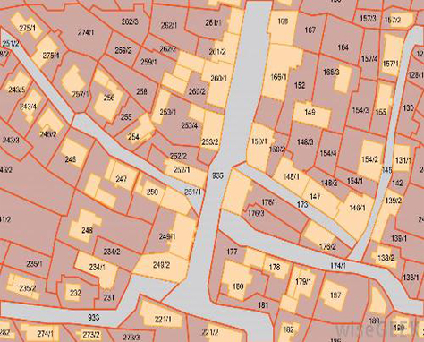
Cadastral Mapping
● Retrieval of old cadastral maps (scan, geo-reference and digitize old paper maps/plans to build spatial database.
● Digitisation of high resolution aerial and satellite images to make cadastral level data). -
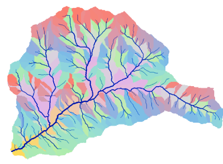
Hydrological Studies
● Generation of High Resolution DEM
● Drainage System Development
● Flood Risk Assessment
● Hydrological modeling and parameterization. -
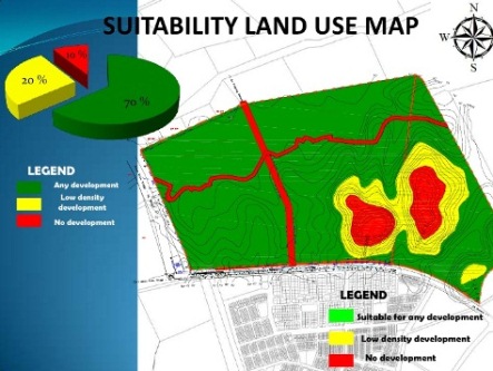
Site Suitability Studies
We are expertise in analyzing zoning restrictions, buffer requirements, vulnerable Ecosystems, flood-prone areas, distance to sensitive areas to assess the site suitability .